Mapbase
On-demand, high-resolution LiDAR-based terrain.
- Founder
- 2024 to present
- Geospatial data, procedural terrain
Problem
Real-world terrain for games, film and visualization starts with GIS work: finding LiDAR coverage, converting point clouds and cleaning rasters. It is slow, manual, and has to happen before any 3D work begins.
How it works
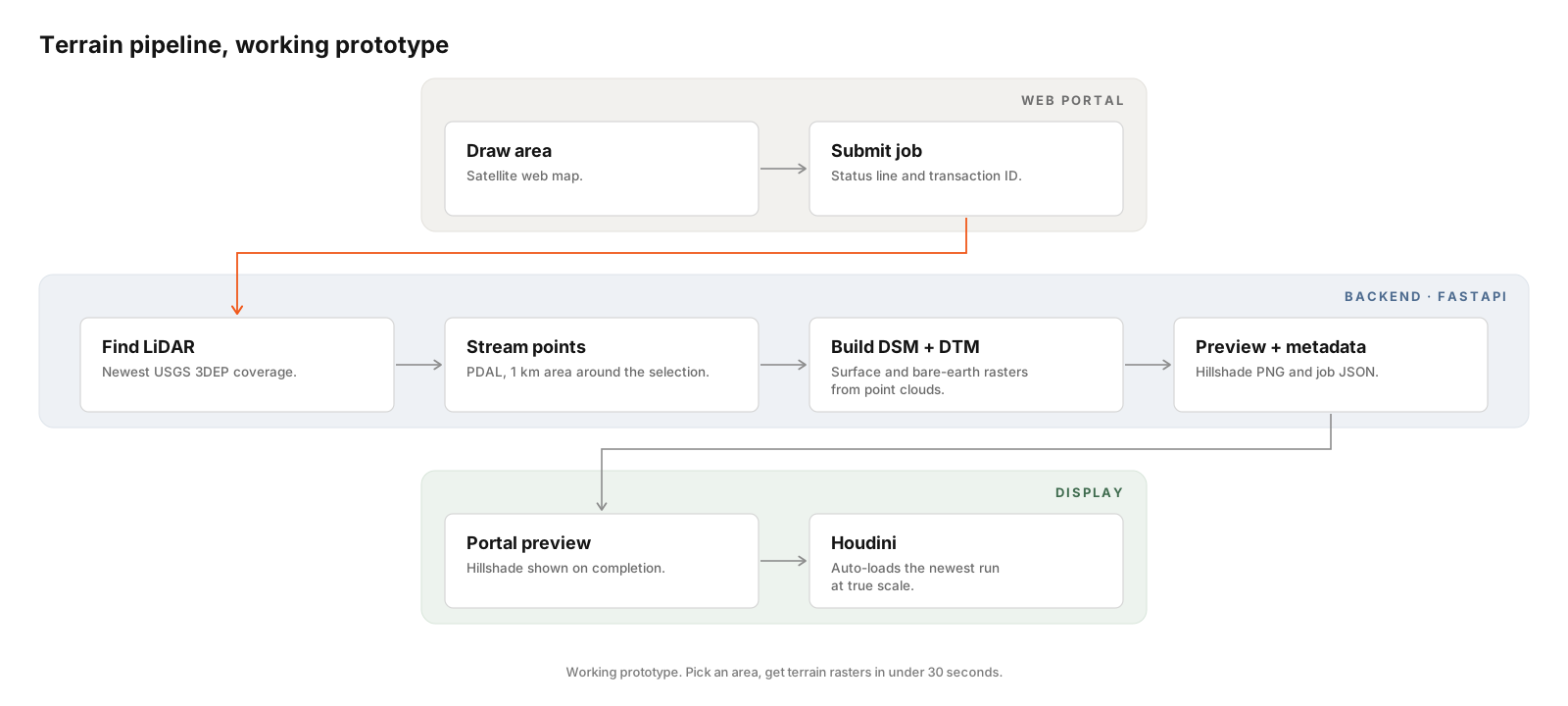
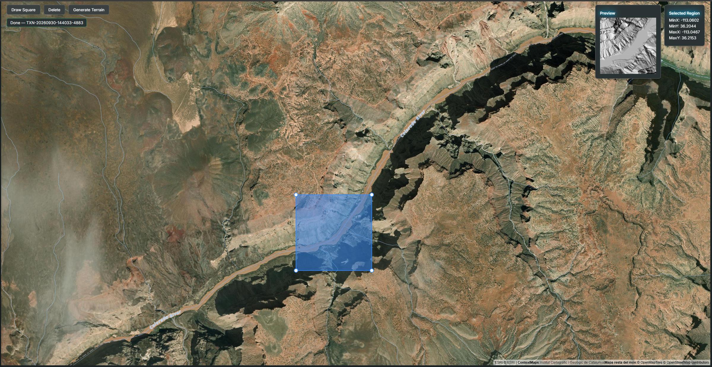
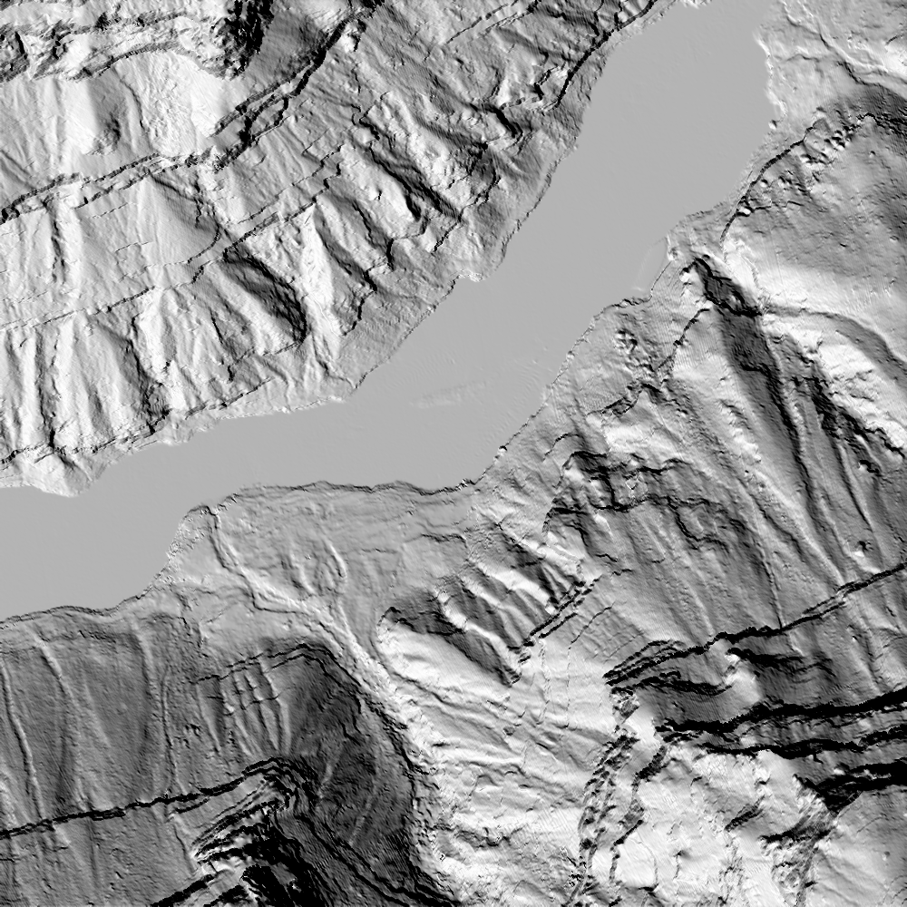
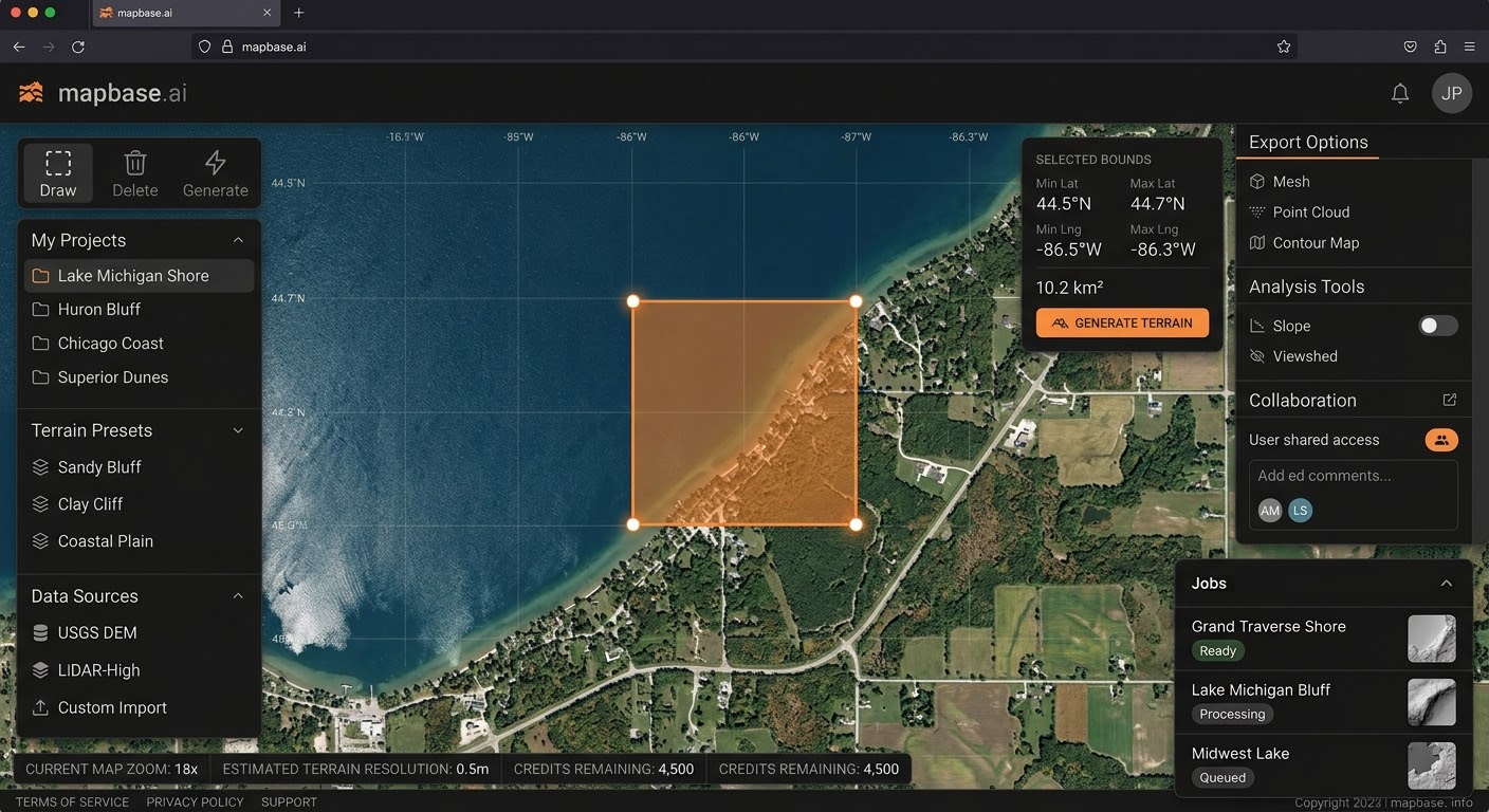
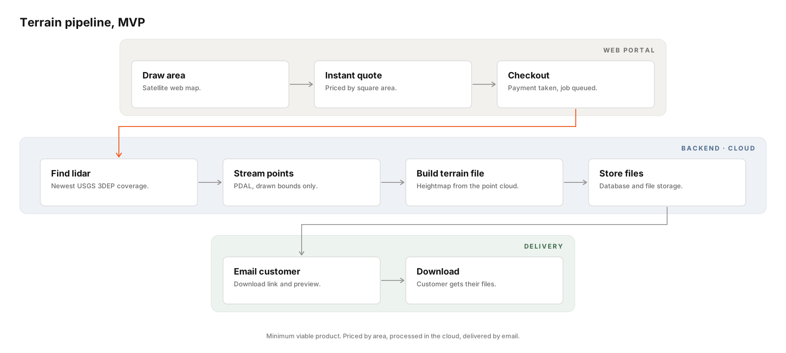
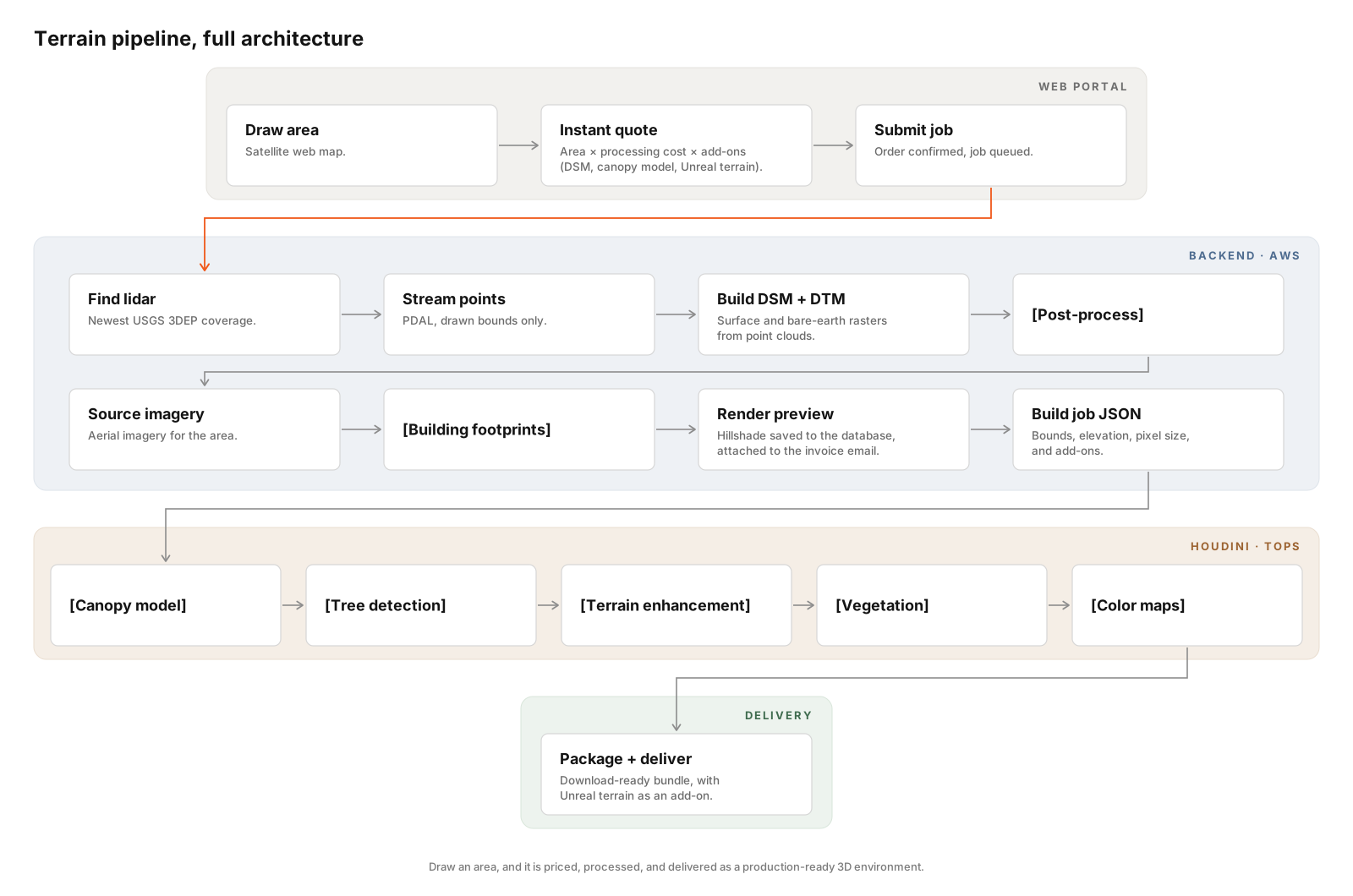
Pick an area on a satellite map and submit. The backend finds the newest USGS 3DEP LiDAR that covers it, streams the points through PDAL, and builds two 1m rasters: a surface model with trees and buildings, and a bare-earth terrain model. A hillshade preview appears in the portal when the job finishes.
The portal
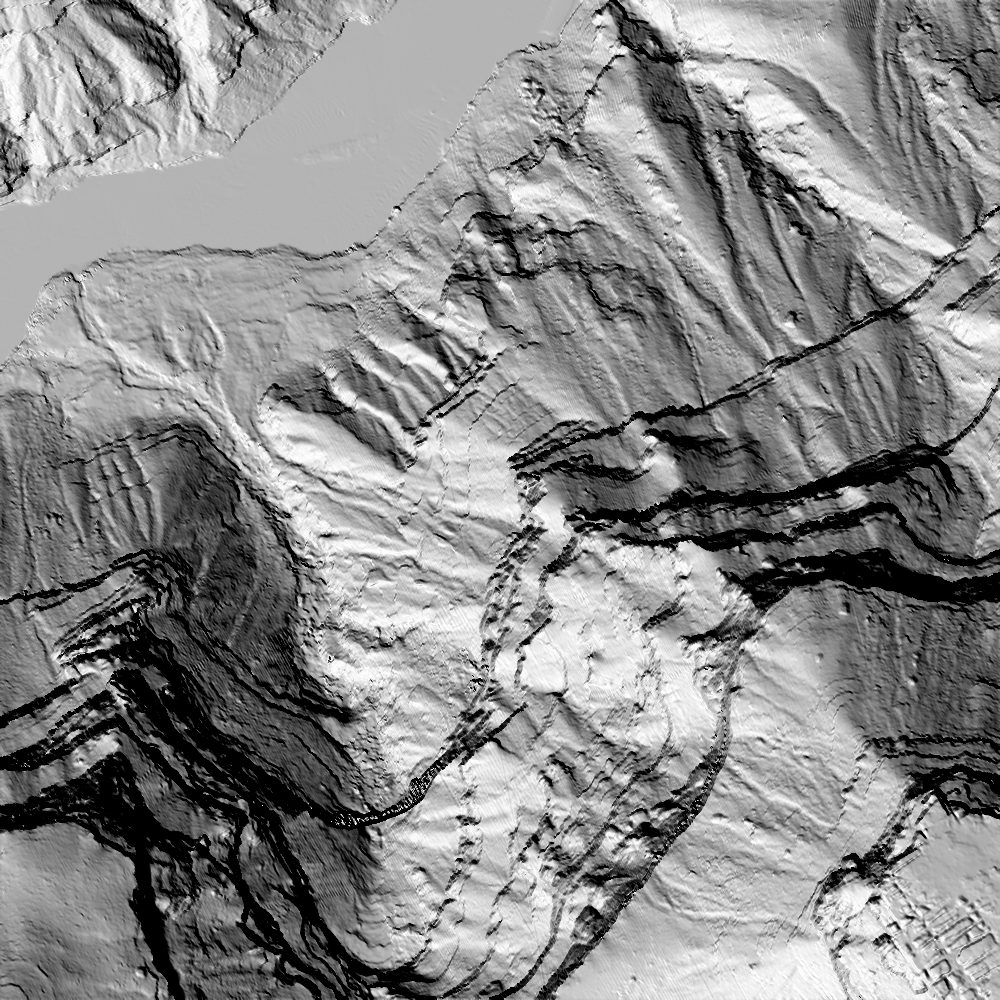
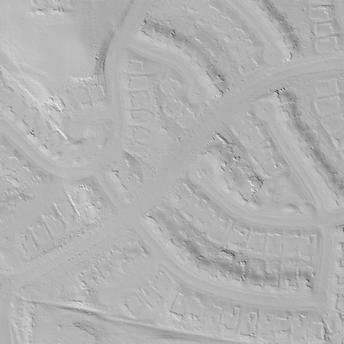
Cleaning the data
Noise returns are dropped, water returns are kept, and any remaining holes are filled, either smoothly or flat at the waterline.
Into Houdini
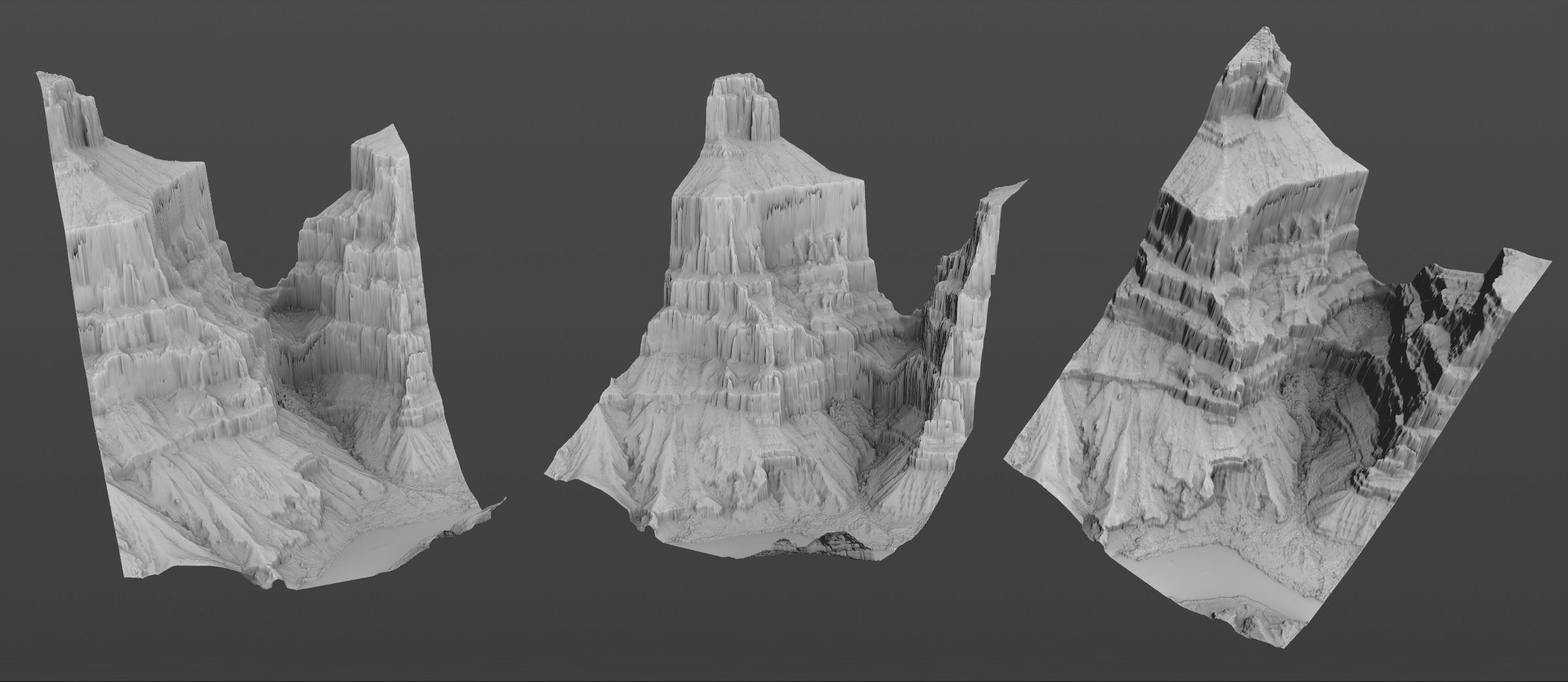
The rasters load into Houdini as a heightfield at true scale. Today that handoff is manual.
Concepts
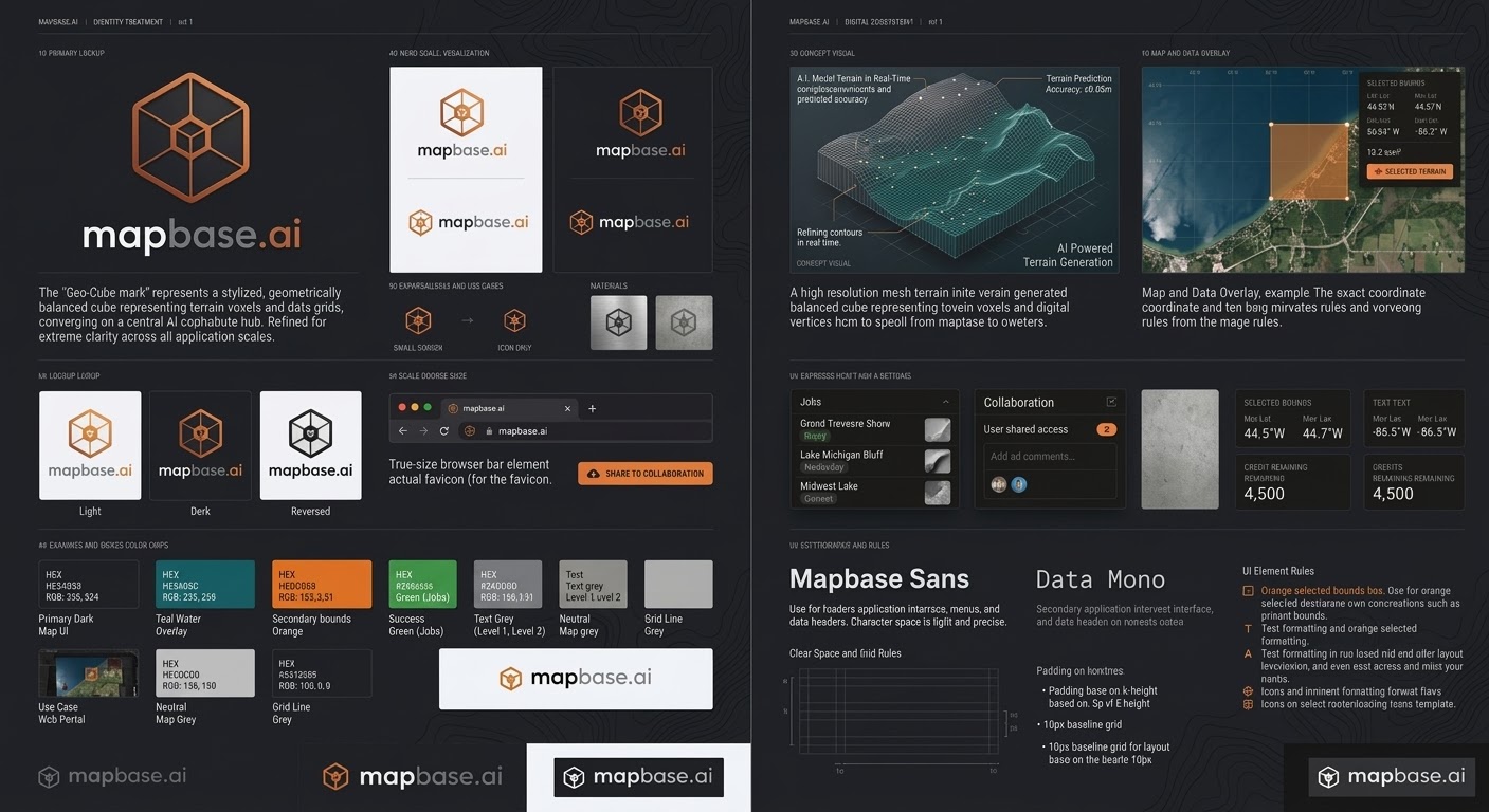
Brand and portal direction, explored with AI image tools before the build. These are concepts, not product screens. The working prototype portal is shown above.
Where it’s going
The plan adds instant pricing, checkout, cloud processing, and add-ons like canopy models and Unreal-ready terrain.
Result
- Working prototype, end to end: map selection to surface and terrain rasters with a preview.
- 1m rasters over a 1 km² area per job, in under 30 seconds in testing.
- Tested on Kansas lakeshore and Grand Canyon terrain.
- Backed by 31 automated tests.
Stack
Next
Honor the drawn area exactly, hand finished runs to Houdini automatically, then move processing to a hosted backend.